GIS solutions for drinking water and wastewater networks

A GIS for water networks enables you to centralise, improve the reliability of and use geographic data for assets that are largely underground.
Dotic supports local authorities, intermunicipal associations, operators, delegated service operators and engineering consultancies in managing drinking water, wastewater and stormwater networks: asset knowledge, field operations, quality control and decision support.
This page presents the operational challenges of the water cycle, the data to structure, use cases and the role of the StaR-Eau geospatial standard.
Explore some use cases for our solutions dedicated to water networks
Geospatial data as a strategic asset for water networks
Water utilities manage underground networks that are old and often documented across several tools. The quality of geographic data directly affects the safety of field operations, service continuity and renewal decisions.
A shared data repository facilitates collaboration between local authorities, operators, delegated service operators, engineering consultancies and service providers, while preserving network knowledge over time.
To remain reliable and usable, data follows a continuous lifecycle:
- Collect information in the field.
- Structure features and attributes within a shared model.
- Check completeness, consistency and compliance.
- Use data in a GIS or Web GIS.
- Update the repository after every construction project or field operation.
Key operational challenges in monitoring water and wastewater networks
Field updates after construction and field operations
Networks change constantly: leak repairs, new or removed service connections, replacement of pipe sections and new construction. When these changes are not incorporated promptly, the GIS gradually becomes outdated.
Objective:
Collect changes directly in the field, check them and then incorporate them into the repository.
Reliability and asset knowledge
Inaccurate or outdated data makes assets harder to locate, compromises field operations and reduces the reliability of maintenance and renewal decisions.
Objective:
Maintain a reliable asset database to support decisions, prioritise construction work and preserve network knowledge for future handovers.
Traceability and history
Keeping a history of field operations, the assets involved, dates and changes supports service continuity, accountability and long-term network analysis.
Key geographic data for drinking water, wastewater and stormwater
Technical and asset attributes
- Diameter, material, pressure
- Installation year, condition, intervention history
- Asset references
- Field photos and documents
Networks and assets
- Drinking water, wastewater and stormwater pipes
- Service connections
- Valves, fire hydrants, air valves
- Manholes, drainage inlets, outfalls
- Reservoirs, stations, pumping stations
Contextual data
- Roads, land parcels, easements
- Other underground networks
- Sensitive areas (water abstraction points, protection zones)
StaR-Eau: a geospatial standard providing a framework for water network data
Modelling, standardisation and domain expertise
StaR-Eau provides a common framework for describing and exchanging drinking water and wastewater network data. It specifies the features, attributes and relationships needed for understandable, reusable data.
Dotic draws on its expertise in geographic data modelling and processing to put this standard into practice in tools and operational workflows.
In practical terms, Dotic solutions enable you to:
- Collect and update field data with ConnectField.
- Check structure, completeness and consistency with ConnectControl.
- Visualise, edit and use the repository in the ConnectServices Web GIS.
- Query data in natural language with ConnectQuery when this use is relevant.
A way to improve data reliability and sharing
A repository structured according to StaR-Eau facilitates:
- shared understanding of data between stakeholders;
- consistent deliverables;
- changes of service provider or tool;
- preservation of asset knowledge over time.
The standard organises data, but does not by itself guarantee completeness or consistency: quality checks and continuous updates remain essential.
Our conviction
Without relevant GIS tools suited to operational needs, the standard remains theoretical.
With suitable tools, it becomes a real operational asset.
Explore use cases to improve the reliability and use of water network data

Drinking water and wastewater network audits
A complete solution — mobile application and Web GIS — to save time and improve reliability
Construction monitoring and operational quality control
A GIS software suite to structure your data and monitor network deployment work
Network design and data editing
Take control of your infrastructure data from network design through to operation
Planning field operations on water networks
Plan and monitor your field operations: construction, audits, maintenance, connections…
Snagging resolution for water distribution
Track construction acceptance and the resolution of outstanding items accurately
Class A as-built surveys for your water networks
Centimetre accuracy with ConnectField for your Class A as-built surveys
Data quality control and StaR-Eau compliance
Collect, assess, structure, manage and share your data on a reliable basis
Data validation during construction
Manage construction work and monitor data quality and Star-Eau compliance
A GIS software suite supporting the management of drinking water and wastewater networks
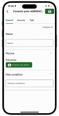
Collect
Collect and update data directly in the field with a mobile GIS application.

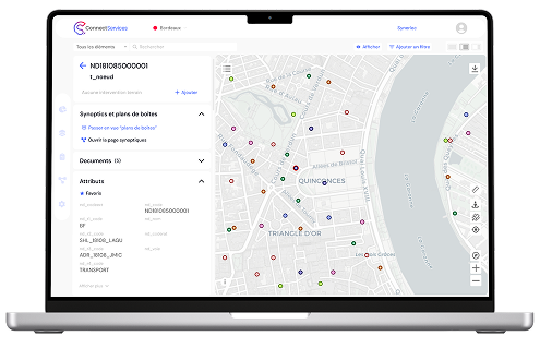
Use
Visualise, edit, administer and use your water network data in a shared Web GIS.

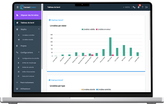
Check
Structure your data and check its quality, consistency and compliance, particularly with StaR-Eau.

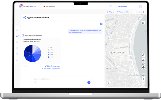
Query
Query and analyse your geographic data in natural language with AI dedicated to GIS.

Would you like to improve the reliability of your GIS data for drinking water supply, wastewater or stormwater?
Put StaR-Eau into operational practice
Improve the reliability of field updates
Safeguard data quality and traceability