GIS solutions for managing fibre optic and FTTH networks

Dotic supports operators, local authorities, intermunicipal associations, engineering consultancies and infrastructure managers with GIS solutions dedicated to FTTH, FTTE, FTTB and FTTO fibre optic networks. From design to maintenance, its tools collect, structure, check, centralise, visualise and query the network’s geographic data.
Following large-scale deployment, the challenges now concern operations, connections, extensions, maintenance, knowledge of network assets and the long-term continuity of the GIS reference dataset. Geographic data becomes a living operational reference, rather than simply an end-of-works deliverable.
Dotic draws on its GraceTHD expertise and the complementary capabilities of ConnectField, ConnectServices, ConnectControl and ConnectQuery to improve the reliability and use of data throughout the network lifecycle.
Explore some use cases for our solutions dedicated to processing and unlocking the value of fibre optic network data
Why are GIS and geographic data essential for an FTTH network?
Fibre optic networks feature a very high density of objects, ongoing changes (connections, extensions, repairs) and operations involving multiple stakeholders (operators, local authorities, subcontractors).
Geographic data, and its use, becomes the common foundation throughout the life of networks.
Poorly structured or poorly used data leads to network performance issues and often additional costs associated with:
- Difficulties with interventions and the reliability of certain connections
- Loss of knowledge about network information
- Higher costs for corrective maintenance than for preventive maintenance
- An inability to plan changes and make the best decisions
What geospatial data makes up a fibre optic network?
Functional and relational data
- Upstream / downstream relationships
- Occupancy and reserves
- Network continuity
- Unique identifiers and naming rules
- NRO–PB distance (attenuation calculations)
- Fibre availability (extensions)
- PB saturation
Infrastructure and network
- Optical cable routing
- Optical routes
- Fibres and capacities
- PBO, PM, NRO
- Chambers, ducts, supports
- Connection points and service connections
Operational data
- Asset status
- Intervention history
- Maintenance data
- Areas of responsibility
Data challenges throughout the lifecycle of an FTTH network
Operate and maintain the network day to day
Once the network is in service, data becomes an operational resource for:
- Locating assets precisely
- Preparing interventions
- Tracking incidents
- Coordinating field stakeholders
Objective:
Move from “delivered” data to living, operational data.
Ensure data continuity and long-term usability
- Change of operating organisation
- Takeover by local authorities
- Changes in standards and tools
Objective:
Ensure standardised data that can be transferred and used over time
Have assessed and reliable data
The deployment phase generates large volumes of data from multiple stakeholders.
Challenge: inaccurate or outdated data generally leads to incorrect locations during interventions and uncertainty about the state of the network, undermining maintenance or renewal decisions.
- Ensure data complies with the GraceTHD standard and the operating organisation’s internal reference frameworks
- Detect inconsistencies
- Assess deliverables objectively
This is an essential step in building reliable operations.
Support network extensions and changes
FTTH networks continue to evolve through additional connections, area extensions, adaptations to usage and the decommissioning of the copper network.
Challenge:
- Integrate these changes without compromising data quality
- Maintain the network’s overall consistency
How does Dotic software support an FTTH network?
Collect in the field
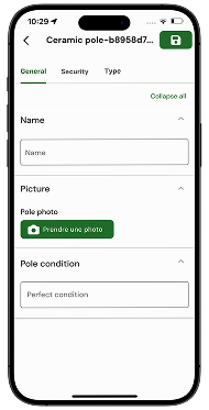
ConnectField collects field data, documents audits and interventions, and helps keep assets up to date.

Centralise and use
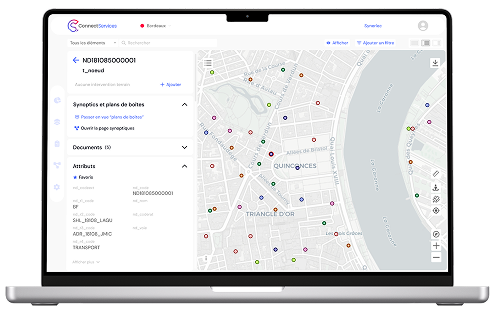
ConnectServices centralises, visualises, edits and shares FTTH/FTTE data in an operational Web GIS.

Structure and check
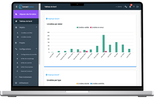
ConnectControl structures data, automates quality checks and verifies compliance with the GraceTHD standard.

Query and analyse
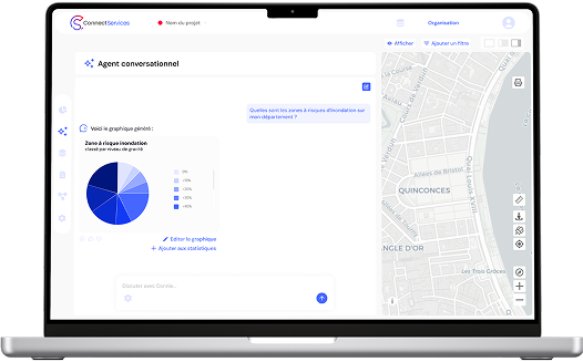
ConnectQuery queries GIS data in natural language to simplify analysis and decision support.

GraceTHD: the French reference standard for structuring FTTH data
Dotic actively participated in creating the GraceTHD standard, giving it a detailed operational understanding of its technical and regulatory requirements.
A common model for fibre optic networks
The GraceTHD standard defines:
- The structure of fibre optic data
- Objects and their relationships
- Consistency rules
- Exchange formats
It forms the common foundation for FTTH projects in France.
From standard to operations: the key challenge
As with any standard, GraceTHD only has value if it is:
- Applied correctly
- Checked systematically
- Integrated into project processes
This is where data checking and quality assessment using a tool such as ConnectControl become central.
A standard at the heart of national challenges
GraceTHD enables:
- Harmonisation of data across territories
- Consolidation at national level
- Comparability of projects
- Long-term data continuity
FTTH data quality control: from collection to operations
In fibre projects, checking data helps to:
- Improve the reliability of decisions
- Secure payments
- Make exchanges between stakeholders objective
- Reduce rework and disputes
Recognised expertise
Dotic has proven expertise in checking and assessing the quality of fibre data, gained through work with:
- Major infrastructure operators
- Local authorities and intermunicipal associations
- National stakeholders overseeing very high-speed broadband deployment
In this context, the Agence Nationale pour la Cohésion des Territoires (ANCT) uses ConnectControl to validate the quality of data submitted by local authorities as part of fibre deployment.

GIS use cases for fibre optic and FTTH networks
Each card presents an operational need and links to the corresponding specialist page:
- Network studies and design;
- Deployment and construction monitoring;
- Connections, incidents and anomalies;
- Operations, maintenance and resilience;
- Data checking, structuring and value creation.

Telecom and FTTH infrastructure audit
A complete solution – mobile application and Web GIS – to save time and improve reliability
Construction monitoring and operational quality control
A GIS software suite to structure your data and monitor deployment works
Tracking and managing incidents and failed connections
A Web GIS feature that provides greater autonomy in monitoring FTTH networks
Network design and data editing
Manage your infrastructure data from network design to operations
Intervention planning
Plan and track your field interventions: construction, audits, maintenance, connections…
Managing snagging resolution
Precisely track end-of-works acceptance and the resolution of outstanding items
FTTH infrastructure resilience
GIS tools for tracking infrastructure throughout its lifecycle
Network data quality assessment and modelling
Ensure reliable, automated checks on your deliverables for optimal operations
Class A as-built surveys
Centimetre-level precision with ConnectField for your Class A as-built surveys
Infrastructure management and decision support
A complete software suite to turn your data into a resource for decision-making
Improve FTTH connection quality
Manage and track FTTH connections. Gain transparency and reliability