High-Precision GNSS Field Surveys with ConnectField

In underground utility and infrastructure projects, data quality depends directly on the accuracy of field surveys and the ability to seamlessly integrate collected information into the GIS environment.

With ConnectField, now compatible with professional GNSS devices, field teams can perform centimetre-accurate surveys in open trenches, structure data directly on site, and synchronise it seamlessly with the ConnectServices Web GIS platform.

The ConnectField mobile GIS solution is compatible with high-precision GNSS devices, including Trimble, PYX (TERIA), and Arrow® devices from EOS Positioning Systems).
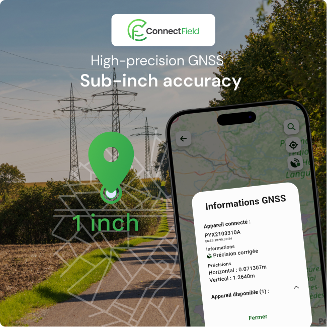
Achieve Survey-Grade Accuracy with Integrated GNSS and GIS

ConnectField is compatible with high-precision GNSS receivers such as PYX (Teria) and Arrow® devices from EOS Positioning Systems.

In the field, this enables:

  • real-time coordinate acquisition with GNSS correction services
  • centimetre-level georeferencing of infrastructure assets
  • immediate association of attribute and inspection data

Using a smartphone or tablet, field operators can:

  • accurately position utility and infrastructure assets
  • capture asset characteristics such as type, material, diameter and status
  • validate and synchronise data directly with the GIS platform

The collected information is automatically integrated into ConnectServices, Dotic’s web-based GIS platform for utility and infrastructure network management, with no manual re-entry or additional data processing required.

GNSS Field Surveys Seamlessly Integrated into Your GIS Workflow

High-accuracy as-built surveys are essential to ensure reliable mapping of underground utility and infrastructure networks after construction works. Achieving this level of precision requires accurate field positioning, robust data capture processes and seamless GIS integration.

This typically involves:

  • surveys performed in open trenches before backfilling
  • the use of high-precision GNSS receivers with RTK/NTRIP correction services
  • structured and standardised field data collection

ConnectField supports this workflow by combining GNSS positioning, attribute data capture and GIS integration within a single mobile field solution.
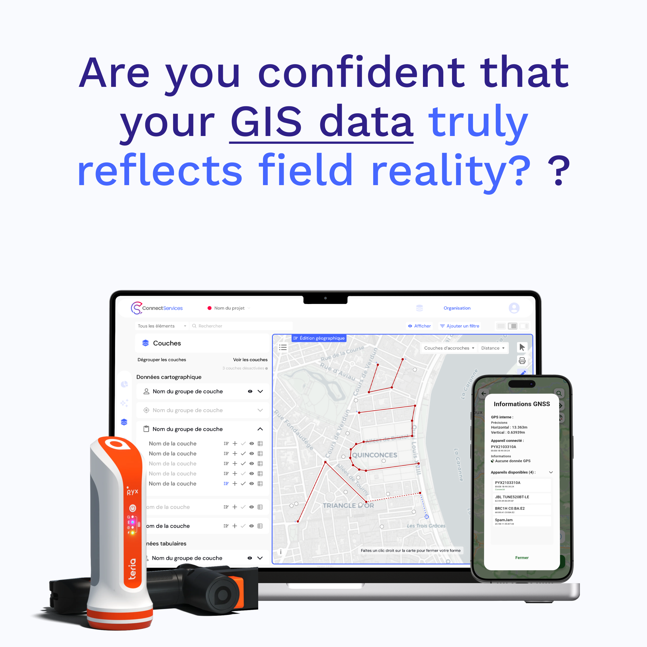
ConnectField GNSS connectivity for high precision field data collection

Supporting PAS 128-Compliant Utility Surveys with GNSS and GIS

In the UK and many international infrastructure projects, accurate mapping of underground utility networks is essential to reduce excavation risks, improve asset reliability and support compliance with standards such as PAS 128.

High-precision utility surveys typically require:

  • centimetre-level positioning accuracy
  • surveys carried out in open trenches before backfilling
  • the use of GNSS receivers with RTK/NTRIP correction services
  • structured and reliable geospatial data capture

ConnectField helps field teams meet these requirements by enabling accurate, standardised data collection directly on site, with seamless integration into GIS workflows.

Learn more about ConnectField

From GNSS Field Survey to GIS Integration: A Seamless Workflow

One of the key challenges in high-precision utility and infrastructure surveys is ensuring continuity between field data capture and GIS data management.

With ConnectField and ConnectServices:

  • field data is collected with centimetre-level accuracy
  • information is structured using dedicated industry-specific forms
  • data is automatically synchronised with the GIS platform

Within ConnectServices, collected data is immediately:

  • visualised in a GIS environment
  • accessible in tabular format
  • ready for reporting and project deliverables
  • exportable to external systems and workflows

This seamless workflow eliminates manual data re-entry and improves the reliability and consistency of the entire geospatial data lifecycle.

Learn More About Our Complete Field Operations Solution

Use Case: High-Precision Utility Mapping After Construction Works

Context and Objectives of Field Visual Inspections

Following the installation or modification of utility networks such as water, fibre optic or electrical infrastructure, field teams must:

  • accurately survey assets in open trenches before backfilling
  • document technical asset characteristics
  • produce reliable as-built utility mapping deliverables compliant with industry standards such as PAS 128
  • integrate collected data into the organisation’s GIS and asset management systems

Field Deployment and Data Capture Workflow

With ConnectField, the workflow is immediately operational in the field:

  • connect the GNSS receiver to the smartphone
  • activate the NTRIP correction service
  • survey technical points with centimetre-level accuracy
  • capture attributes using structured forms
  • validate and synchronise data with the ConnectServices GIS platform

Survey results and Geospatial Data management

The collected data is:

  • aligned with industry standards for high-accuracy utility mapping
  • immediately available within the GIS platform
  • ready to support as-built documentation and infrastructure asset management workflows

Field teams benefit from reliable, up-to-date geospatial data that is immediately ready for operational use.

Accuracy, Traceability and Reliability of Asset Data

Integrating GNSS technology into field data collection workflows helps ensure:

  • centimetre-level positioning accuracy suitable for high-precision utility and infrastructure surveys
  • full traceability of survey operations, including timestamps and measurement conditions
  • improved reliability and consistency of utility network data

These capabilities are essential for:

  • improving safety during excavation and maintenance operations
  • enhancing infrastructure asset management
  • supporting compliance with industry standards and utility mapping requirements such as PAS 128 in the UK
Logo ConnectField

FAQ – High-Precision Utility Surveys and GNSS Field Data Collection

What Is a PAS 128 Utility Survey?

A PAS 128 utility survey refers to a high-quality standard for the detection, verification and mapping of underground utility networks in the UK. It defines best practices for capturing reliable geospatial data and improving the accuracy of underground asset records. These surveys typically rely on: high-precision GNSS positioning open-trench surveys when available structured geospatial data collection workflows detailed documentation of underground infrastructure assets The objective is to improve data reliability, reduce excavation risks and support safer infrastructure and utility network operations.

How Can You Perform a High-Accuracy Utility Survey in the Field?

High-accuracy utility surveys are typically performed in open trenches before backfilling to ensure accurate positioning of underground infrastructure assets. This process relies on precise measurement technologies, usually combining professional GNSS receivers with RTK/NTRIP correction services, as well as field applications capable of structuring data directly on site and integrating it seamlessly into a geographic information system (GIS).

Why Use GNSS for Utility and Infrastructure Surveys?

Using GNSS technology enables field teams to achieve centimetre-level positioning accuracy, which is essential for high-precision utility and infrastructure surveys. Professional GNSS receivers provide fast and efficient field deployment while ensuring consistent measurement quality across projects. When combined with RTK/NTRIP correction services, GNSS devices improve the reliability of field surveys and support compliance with utility mapping standards such as PAS 128 in the UK.

Can You Perform High-Accuracy Utility Surveys with a Smartphone?

A smartphone alone cannot deliver the level of accuracy required for high-precision utility surveys. However, when paired with a professional GNSS receiver, it becomes an efficient field data collection tool capable of capturing accurately georeferenced infrastructure data. Mobile field applications such as ConnectField also enable operators to structure and validate information directly during the survey process, ensuring seamless integration into GIS workflows.

What Data Should Be Collected During a Utility Survey?

A utility survey is not limited to the geographic position of underground assets. It also includes all key network features, such as changes in direction, connection points and field equipment, along with associated attribute data including asset type, material, diameter and operational status. Collecting this information is essential for producing reliable, usable and standards-compliant utility mapping and GIS records.

How Can Utility Survey Data Be Integrated into a GIS?

Field data must be structured and integrated into a geographic information system (GIS) in order to be effectively managed and used. Modern field data collection solutions enable direct synchronisation from the field, eliminating manual data re-entry and significantly reducing the risk of errors. This seamless continuity between field survey operations and GIS integration is a key factor in ensuring reliable, consistent and up-to-date geospatial data.

What Types of Utility Networks Require High-Accuracy Surveys?

High-accuracy utility surveys apply to a wide range of underground infrastructure networks, whether they are classified as critical or non-critical assets. This includes water supply and wastewater networks, electricity and power distribution infrastructure, gas networks, as well as telecommunications and fibre optic systems. Associated infrastructure assets such as manholes, inspection chambers, connection points and service access structures must also be accurately surveyed and documented to ensure reliable utility mapping and consistent GIS records.

How Can You Ensure Compliance in High-Accuracy Utility Surveys?

Compliance relies on several complementary factors. Field teams must use appropriate high-precision surveying equipment, perform surveys in open trenches before backfilling, structure data correctly during collection and maintain full traceability of survey operations. The overall workflow — from field data capture through to GIS integration — also plays a critical role in ensuring reliable, consistent and standards-compliant utility mapping data.

How Can You Improve the Reliability of Utility Survey Data?

The reliability of utility survey data depends both on the accuracy of field measurements and on the quality of data structuring during collection. It also relies on consistent integration into the GIS environment and on minimising intermediate manual processing steps. Integrated workflows that combine data capture, structuring and GIS integration within the same environment now play a key role in significantly improving the quality, consistency and reliability of geospatial infrastructure data.